183A Toll
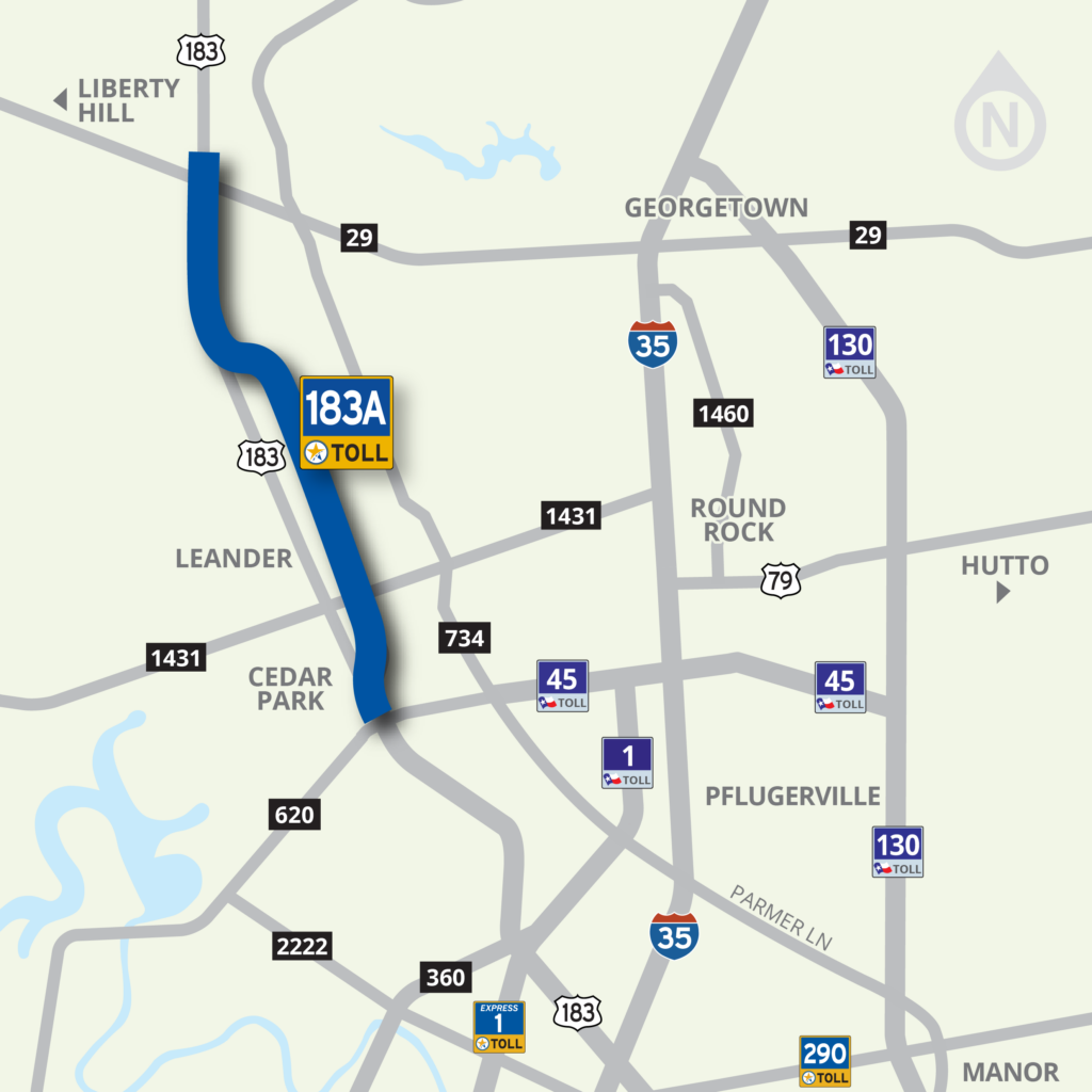
An almost 16-mile toll road extending northward from RM 620 through Cedar Park and Leander in Williamson County
Those looking to bypass traffic congestion have a choice to use 183A Toll. Drivers who prefer not to pay a toll can use the non-tolled lanes on US 183 or the 183A frontage roads north of RM 1431.
Use Your Electronic Tag or Drive on Through, We’ll Bill You
183A Toll is completely automated with no need to stop or even slow down at toll booths. The choice is yours – utilize the all-electronic, or cashless, tolling method of payment through an electronic tag account; or if you don’t have an electronic tag just keep moving, and we’ll bill you through the Pay By Mail program.
In Texas, there are multiple transportation agencies that are authorized to operate toll roads, issue their own electronic tag, and do their own billing. In the Austin area, there are two: the Texas Department of Transportation (TxDOT) and the Central Texas Regional Mobility Authority (Mobility Authority).
Mobility Authority customers can pay their tolls with a TollTag, EZ TAG, Fuego Tag, K-TAG, Pikepass, SunPass, E-470’s ExpressToll or Bancpass (the Mobility Authority also accepts TxTAG which is now operated by HCTRA) and get a 33% discount, or they can choose to Pay By Mail. Pay By Mail customers are billed using a picture of their license plate, and are charged a $1.00 statement fee per bill. Vehicle registration information must be up to date in order for the bill to be sent to the correct address. Pay By Mail is available on all toll roads in Central Texas, although you may receive separate bills depending on which agency operates the road you traveled on.
To learn about paying your tolls, see the download available below.
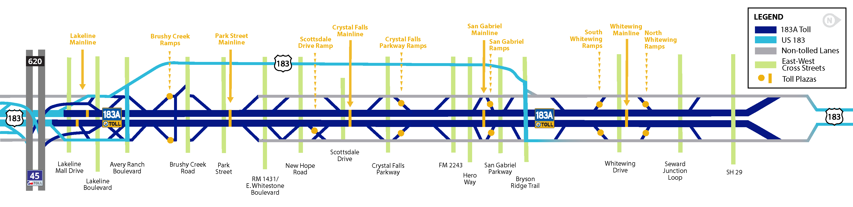
183A Toll: 2025 Rates
 |
2 Axle | 3 Axle | 4 Axle | 5 Axle | 6 Axle | |||||
|---|---|---|---|---|---|---|---|---|---|---|
| TxTag | Pay by Mail | TxTag | Pay by Mail | TxTag | Pay by Mail | TxTag | Pay by Mail | TxTag | Pay by Mail | |
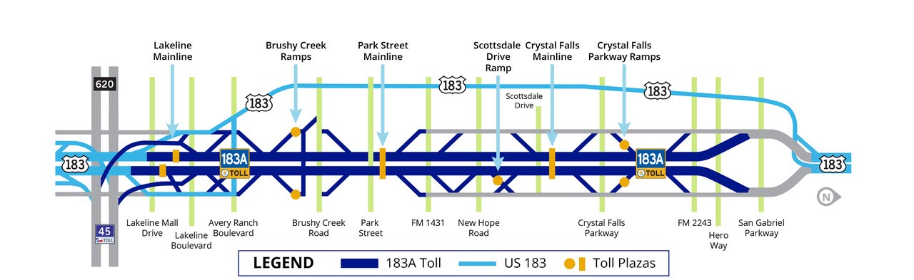
| Lakeline Mainline | $0.78 | $1.17 | $1.56 | $2.34 | $2.34 | $3.51 | $3.12 | $4.68 | $3.90 | $5.85 |
| Brushy Creek Ramps | $0.76 | $1.14 | $1.52 | $2.28 | $2.28 | $3.42 | $3.04 | $4.56 | $3.80 | $5.70 |
| Park Street Mainline | $1.94 | $2.91 | $3.88 | $5.82 | $5.82 | $8.73 | $7.76 | $11.64 | $9.70 | $14.55 |
| Scottsdale Drive Ramps | $0.76 | $1.14 | $1.52 | $2.28 | $2.28 | $3.42 | $3.04 | $4.56 | $3.80 | $5.70 |
| Crystal Falls Mainline | $1.43 | $2.15 | $2.86 | $4.30 | $4.29 | $6.45 | $5.72 | $8.60 | $7.15 | $10.75 |
| Crystal Falls Ramps | $0.62 | $0.93 | $1.24 | $1.86 | $1.86 | $2.79 | $2.48 | $3.72 | $3.10 | $4.65 |
| San Gabriel Mainline | $1.09 | $1.64 | $2.18 | $3.27 | $3.27 | $4.91 | $4.36 | $6.54 | $5.45 | $8.18 |
| San Gabriel Ramps | $0.76 | $1.14 | $1.52 | $2.28 | $2.28 | $3.42 | $3.04 | $4.56 | $3.80 | $5.70 |
| South Whitewing Ramps | $0.76 | $1.14 | $1.52 | $2.28 | $2.28 | $3.42 | $3.04 | $4.56 | $3.80 | $5.70 |
| Whitewing Mainline | $1.29 | $1.94 | $2.58 | $3.87 | $3.87 | $5.81 | $5.16 | $7.74 | $6.45 | $9.68 |
| North Whitewing Ramps | $1.02 | $1.53 | $2.04 | $3.06 | $3.06 | $4.59 | $4.08 | $6.12 | $5.10 | $7.65 |
Phases I, II, & III
Phase I. A tolled roadway between RM 620 and RM 1431, with non-tolled frontage roads northward from RM 1431 northward to the San Gabriel River. It opened in March 2007.
Phase II. A 5-mile extension northward from RM 1431 to Hero Way. The extension opened in April 2012 and resulted in a significant shift of traffic from the non-tolled frontage roads to the new tolled mainlanes.
Intersection Improvements. Non-tolled operational improvements and enhancements to the US 183/183A (North) intersection were delivered to make the intersection safer and easier to navigate, and to enable better access to developments along 183A. The project entailed pavement widening, drainage improvements, signal adjustments, and minor new road construction of CR 276. It also included access road reconstruction on the west side of the intersection and stub out connection for the future extension of a new road, Bryson Ridge Trail, on the east side of the intersection. The improvements facilitate smoother and safer turning movements and feature a more traditional design for improved access across the southbound lanes. These safety and operational enhancements were made possible through a partnership that included the Texas Department of Transportation (TxDOT), the City of Leander through the Pass Through Program, and an adjacent developer (currently Crescent) opened to traffic in September 2015.
Phase III. A 5-mile extension northward from Hero Way to north of SH 29 that opened in early 2025 and aided significant congestion relief along a growing corridor. Construction continues on non-tolled operational improvements and enhancements, including the addition of an adjacent Shared Use Path, are anticipated to be completed in 2025.
183A Added Capacity. Due to the unprecedented growth of Williamson County and growing number of drivers on the 183A Toll Road, the Mobility Authority is conducting an environmental study for the possible addition of a fourth lane in the center median of 183A Toll in both directions between FM 620 and Hero Way. An additional lane would be a proactive measure that would allow for the 183A Toll Road to accommodate future traffic volumes.
Bicycle & Pedestrian Facilities. 183A Toll Shared Use Path includes a 10-foot-wide, 7-mile-long dedicated bicycle and pedestrian path that borders the 183A facility from South Brushy Creek to Hero Way. It also includes a trailhead and pedestrian bridge that crosses Brushy Creek as well as a connection to Williamson County’s Brushy Creek Regional Trail.
Publications and Resources
- 183A Toll has significantly improved travel times and reduced traffic on adjacent roadways including US 183.
- Drivers using 183A emit significantly less pollutants associated with global warming and unhealthy ground level ozone. Drivers also use less fuel.
For more information review the downloads below.
Downloads & Resources
-
01.
-
02.
-
03.
-
04.
Images
-
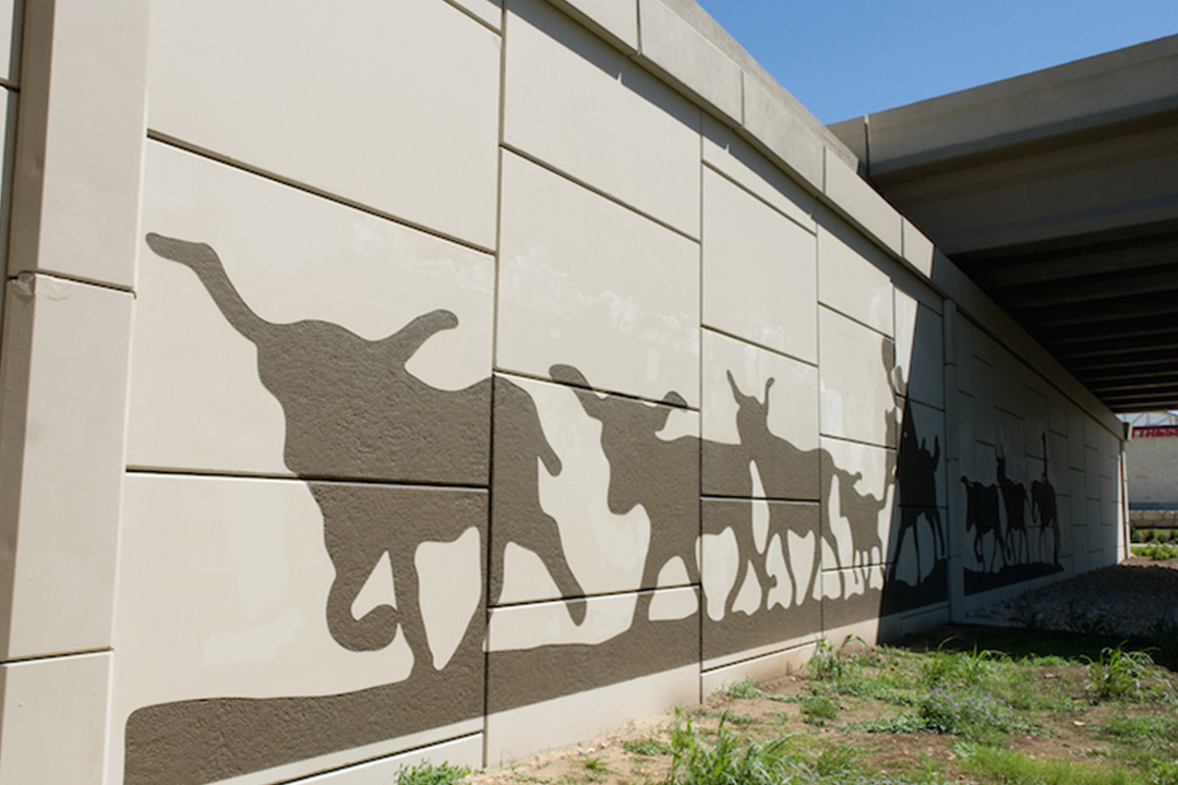
Mural at FM 1431 -
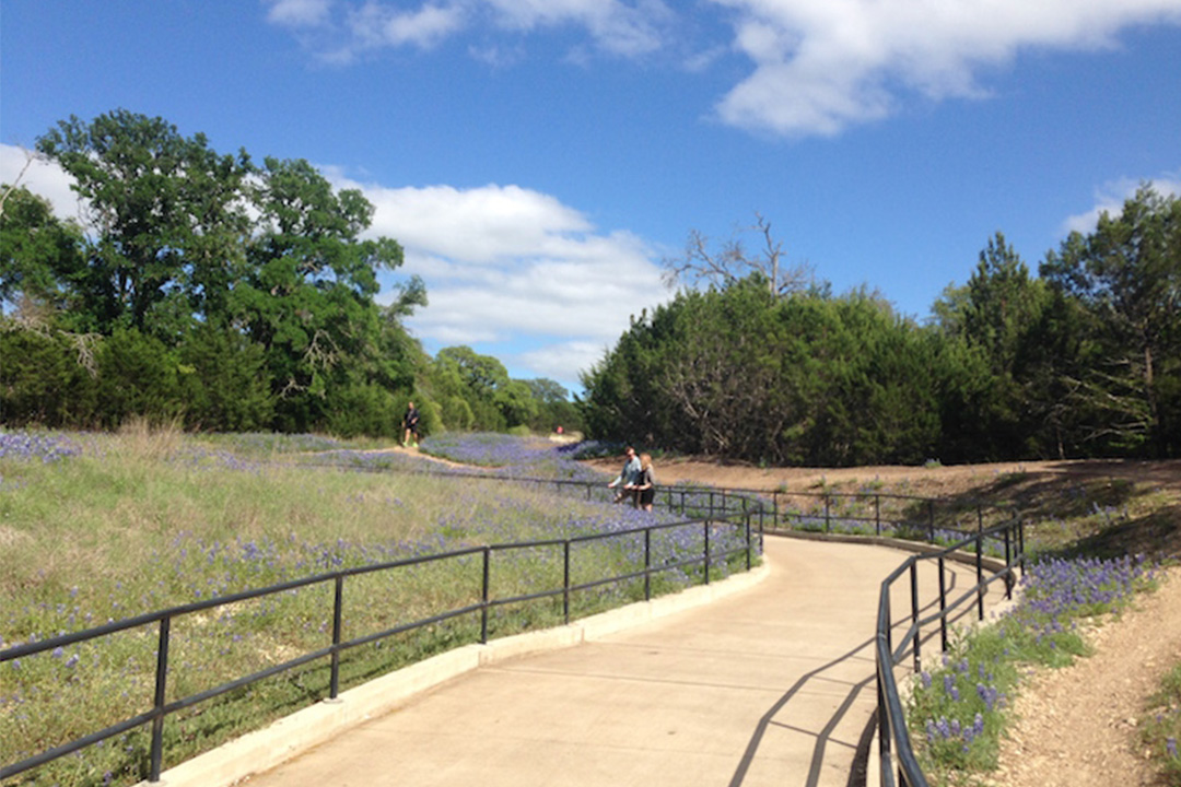
183A Shared Use Path -
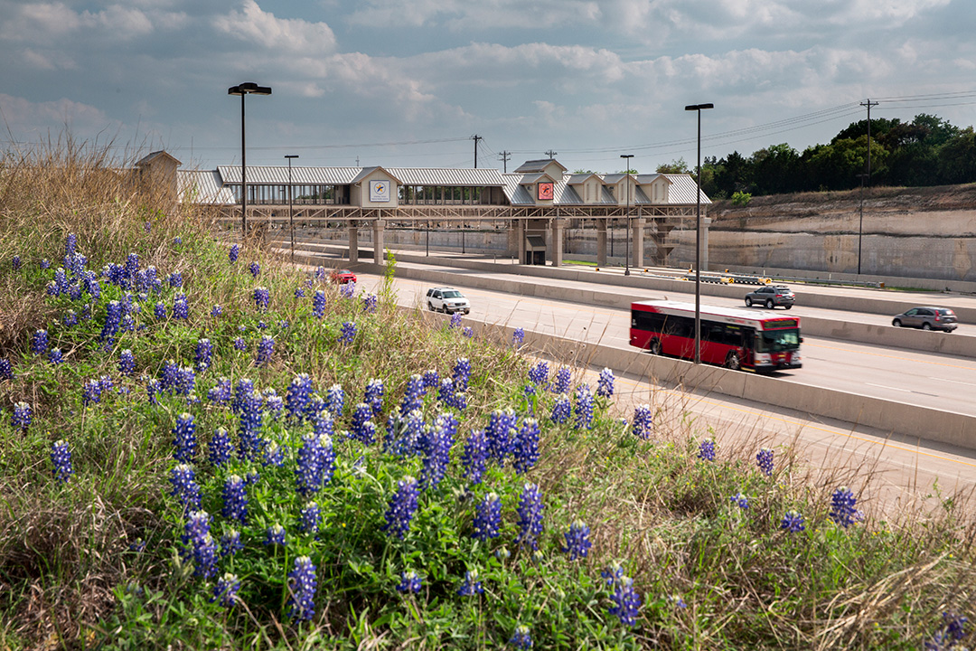
183A Roadway -
Mural at FM 1431 -
183A Shared Use Path -
183A Roadway -
Mural at FM 1431

