183 Toll
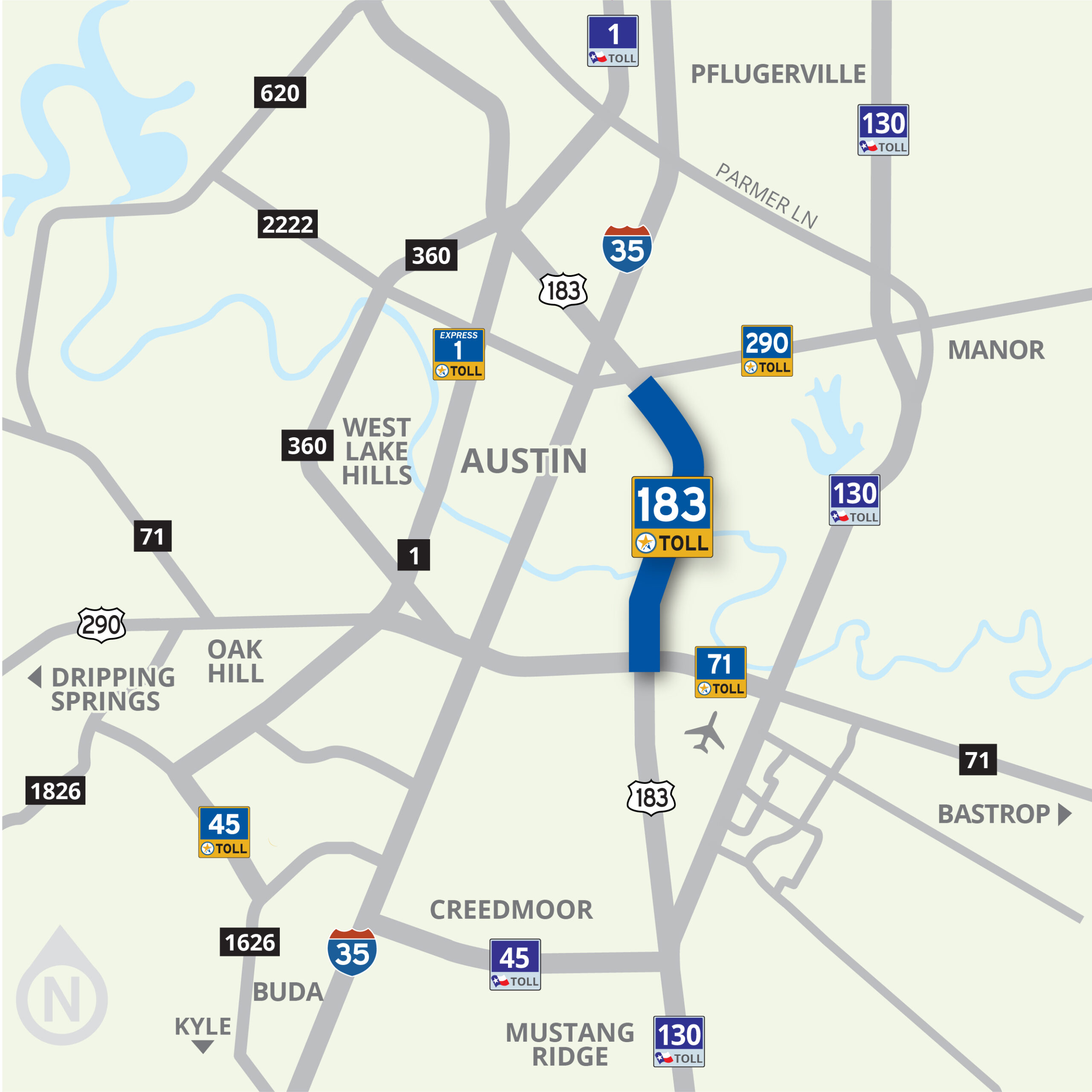
An 8-mile toll road along US 183 from US 290 to SH 71 in east Austin
Those looking to bypass traffic congestion have a choice to use 183 Toll. Drivers who prefer not to pay a toll can use the improved non-tolled general-purpose lanes of US 183.
Use Your Electronic Tag or Drive on Through, We’ll Bill You
183 Toll is completely automated with no need to stop or even slow down at toll booths.
The choice is yours – utilize the all-electronic, or cashless, method of toll payment through an electronic tag account; or if you don’t have an electronic tag just keep moving, and we’ll bill you through the Pay By Mail program.
In Texas, there are multiple transportation agencies that are authorized to operate toll roads and do their own billing. In the Austin area, there are two: the Texas Department of Transportation (TxDOT) and the Central Texas Regional Mobility Authority (Mobility Authority).
Mobility Authority customers can pay their tolls with a TollTag, EZ TAG, Fuego Tag, K-TAG, Pikepass, SunPass, E-470’s ExpressToll or Bancpass (the Mobility Authority also accepts TxTAG, which is now operated by HCTRA) and get a 33% discount, or they can choose to Pay By Mail. Pay By Mail customers are billed using a picture of their license plate, and are charged a $1.00 statement fee per bill. Vehicle registration information must be up to date in order for the bill to be sent to the correct address. Pay By Mail is available on all toll roads in Central Texas, although you may receive separate bills depending on which agency operates the road you traveled on.
To learn about paying your tolls, see the download available below.
183 Toll: 2025 Rates
 |
2 Axle | 3 Axle | 4 Axle | 5 Axle | 6 Axle | |||||
|---|---|---|---|---|---|---|---|---|---|---|
| TxTag | Pay by Mail | TxTag | Pay by Mail | TxTag | Pay by Mail | TxTag | Pay by Mail | TxTag | Pay by Mail | |
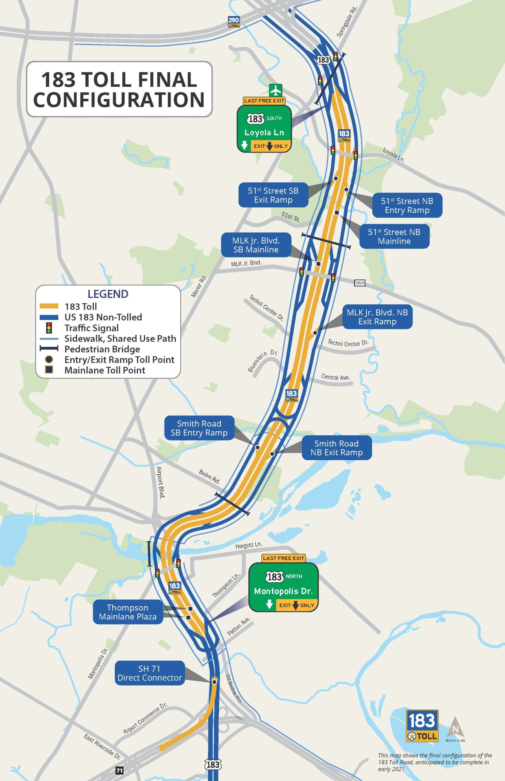
| 51st Street SB Exit Ramp | $0.81 | $1.22 | $1.62 | $2.44 | $2.43 | $3.66 | $3.24 | $4.88 | $4.05 | 6.10 |
| MLK Jr. Blvd. SB Mainline | $1.50 | $2.25 | $3.00 | $4.50 | $4.50 | $6.75 | $6.00 | $9.00 | $7.50 | $11.25 |
| 51st Street NB Entry Ramp | $0.81 | $1.22 | $1.62 | $2.44 | $2.43 | $3.66 | $3.24 | $4.88 | $4.05 | $6.10 |
| 51st Street NB Mainline | $1.50 | $2.25 | $3.00 | $4.50 | $4.50 | $6.75 | $6.00 | $9.00 | $7.50 | $11.25 |
| MLK Blvd. NB Exit Ramp | $1.09 | $1.64 | $2.18 | $3.28 | $3.27 | $4.92 | $4.36 | $6.56 | $5.45 | $8.20 |
| Smith Road SB Entry Ramp | $0.71 | $1.07 | $1.42 | $2.14 | $2.13 | $3.21 | $2.84 | $4.28 | $3.55 | $5.35 |
| Smith Road NB Exit Ramp | $0.71 | $1.07 | $1.42 | $2.14 | $2.13 | $3.21 | $2.84 | $4.28 | $3.55 | $5.35 |
| Thompson Lane Plaza | $1.30 | $1.95 | $2.60 | $3.90 | $3.90 | $5.85 | $5.20 | $7.80 | $6.50 | $9.75 |
| SH 71 Direct Connector | $0.71 | $1.07 | $1.42 | $2.14 | $2.13 | $3.21 | $2.84 | $4.28 | $3.55 | $5.35 |
About the 183 Toll
Want more information fast? Download the fact sheet below on 183 Toll.
Beginning in 2011, the Mobility Authority and the Texas Department of Transportation (TxDOT) worked with agencies and the community to develop a reasonable and feasible approach to improving mobility in the corridor to reduce travel times and improve quality of life.
The 183 South Project broke ground in April 2016 and opened in phases with the north end opening in August 2019, and the south end opening in early 2021.
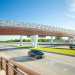
Bicycle & Pedestrian Facilities. The 183 Trail is a 10-foot-wide shared use path adjacent to 183 Toll from US 290 to SH 71. This bicycle and pedestrian route will include pedestrian bridges crossing the highway at Springdale/Manor Road, 51st Street, and Bolm Road. It will also include connections to other regional trails such as the 290 Trail, the Walnut Creek Trail, the Lance Armstrong Bikeway, and the 71 Trail, and trailheads at 51st Street and Levander Loop.
Landscaping & Aesthetic Enhancements. The 183 South Project team incorporated a comprehensive approach to design known as Context Sensitive Solutions (CSS) to create a safe, efficient and environmentally responsible transportation corridor appropriate for its setting that speaks to the needs and values of the surrounding community. As part of the environmental study phase, the Mobility Authority and the Texas Department of Transportation conducted a 16-month CSS planning and public input process that resulted in the design aspects of the 183 South Project that were constructed. This approach allowed for public input to influence the final design such that it reflects the community’s cultural and historic values and aesthetic preferences. The process yielded three priorities described below:
Enhanced Landscape
The community identified enhanced landscape as the primary feature of the CSS design. Special neighborhood-specific tree species were planted to provide a unique focal point for neighborhood entrances along the corridor. Enhanced landscape consists of native, drought resistant plants that reduces water consumption and helps control soil erosion along US 183.
Community Connections
Community connections highlights how the roadway can “knit the community together” by focusing on trailheads, roadway crossings, and intersection improvements for pedestrians. This concept includes wayfinding signs, exercise areas near existing trails, as well as enhanced lighting, shade, and seating along the shared use path.
Regional Identity
Regional identity emphasizes bridge and wall design to promote a strong identity along the corridor. This concept includes the use of unique and attractive design elements for various structures like bridges and retaining walls.
Large Oak Trees
Through community outreach and throughout the CSS Process, we learned that protection of large oak trees within the project corridor was important to the community. The Mobility Authority incentivized the project team to protect and preserve the large live oak trees located within the project limits, just south of Montopolis Drive near Callahan’s General Store. Tree preservation groups and representatives from the City of Austin, the Texas Department of Transportation, and additional stakeholder groups outlined a comprehensive set of Best Management Practices (BMPs) to protect the trees before and during construction.
Images
-

183 Trail Biker on Pedestrian Bridge -
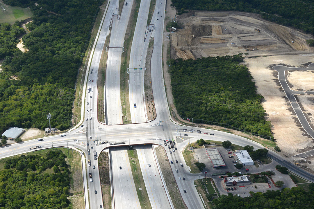
183 Toll at Loyola Lane -
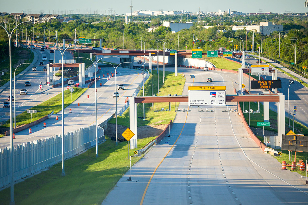
183 Toll Road mainlanes -
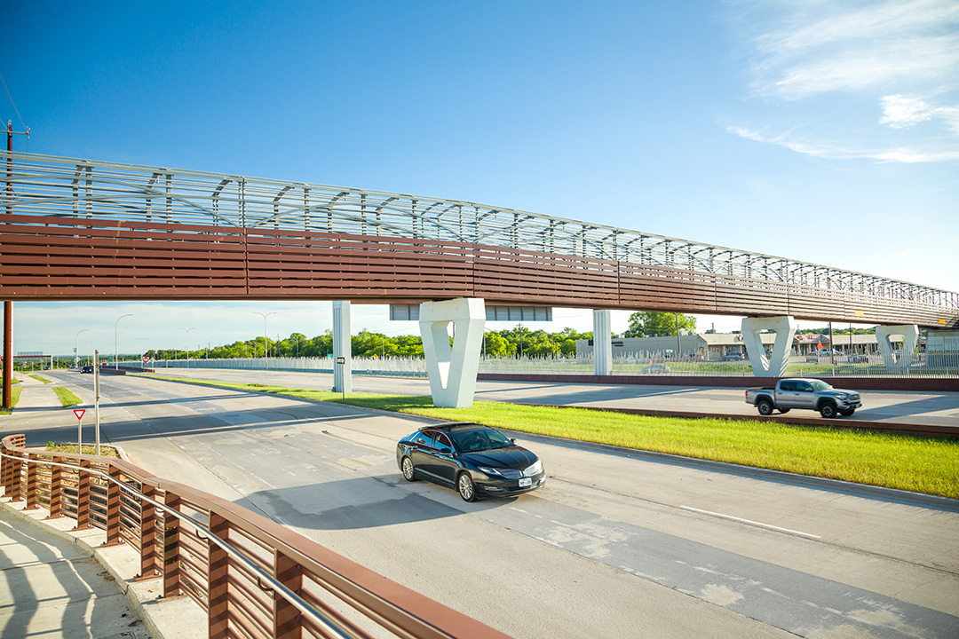
183 Toll Pedestrian Bridge -

183 Trail Biker on Pedestrian Bridge -

183 Toll at Loyola Lane -

183 Toll Road mainlanes -

183 Toll Pedestrian Bridge

