183 Trail
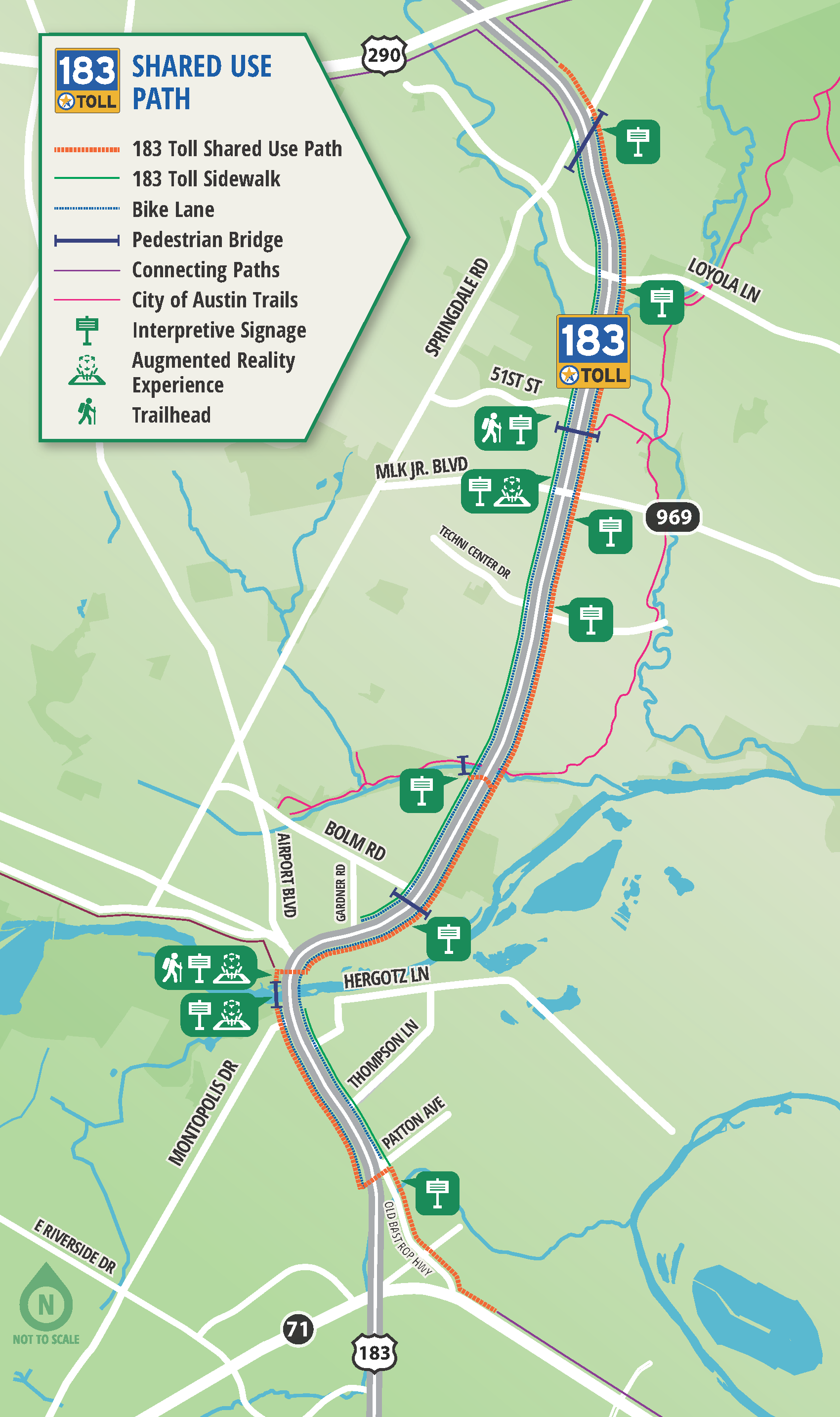
A 10-mile long path along US 183/183 Toll between US 290 and SH 71
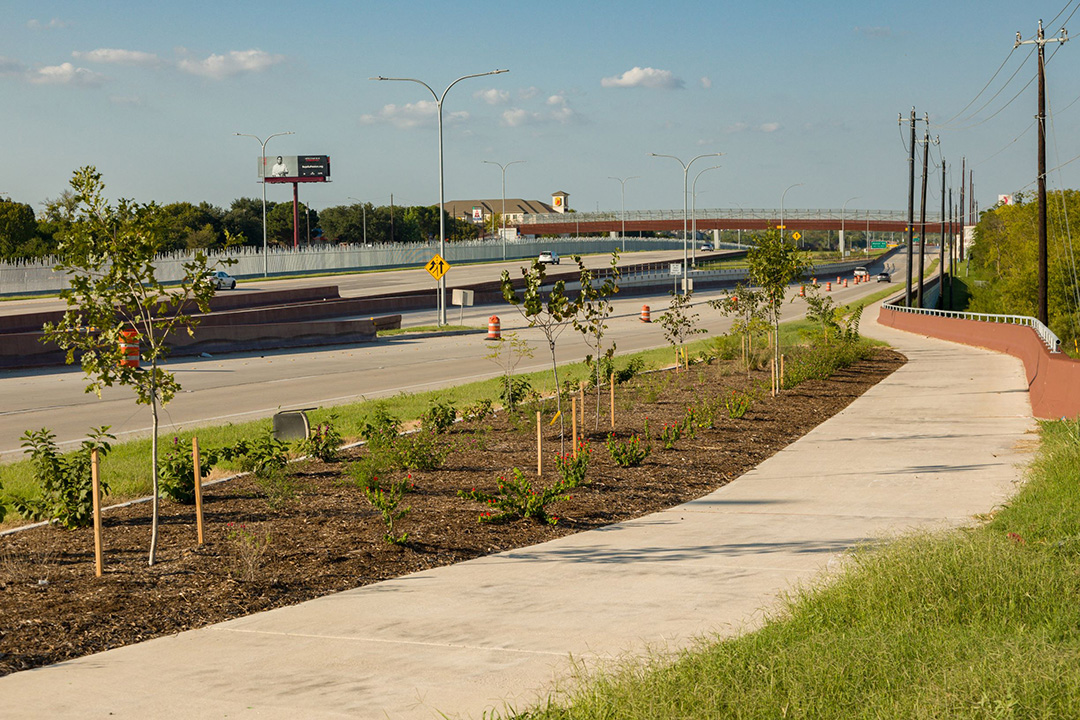
Along the trail, users will find pedestrian bridges, extensive landscaping, and trailheads with exercise equipment, picnic tables, and more for the community to enjoy. The trailheads are located at 51st Street and Levander Loop at the Colorado River. In addition, there is a pocket park at the northwestern corner of US 183 and Martin Luther King Jr. Boulevard/FM 969, the community had dubbed, “Freedom Park.”
And at 12 locations along the corridor, the trail also features interpretive signs highlighting historical, cultural, and environmental information about the surrounding east Austin area with supplemental augmented reality experiences.
Learn more: 183 Trail Signage | 183 Trail Augmented Reality
Accessing the Trail
Trailheads with parking are located at 51st Street and Levander Loop at the Colorado River. However, the trail can be accessed from any point along the US 183/183 Toll corridor between US 290 and SH 71. The trail also connects to the 290 Trail, the Southern Walnut Creek Trail, the Lance Armstrong Bikeway, and the 71 Trail.
Please note that trail users do not have to take the 183 Toll Road to access the trail.
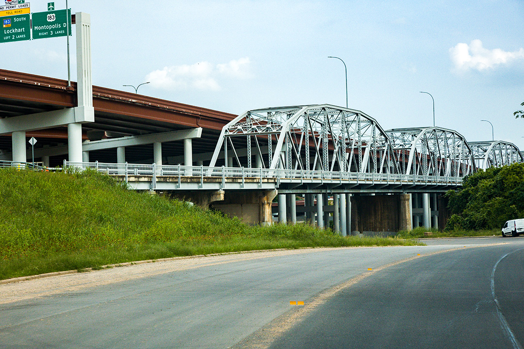
The Montopolis Truss Bridge
Along the trail you’ll find a landmark on the National Register of Historic Places: The Montopolis Truss Bridge. Once the only bridge across the Colorado River in Central Texas, the bridge was decommissioned from vehicular use in 2018, rehabilitated, and now serves as a bicycle and pedestrian bridge and an essential part of the 183 Trail.
Gallery
-

Cyclist on a 183 Trail Pedestrian Bridge -

183 Trail -
Montopolis Truss Bridge -
183 Trail -

Cyclist on a 183 Trail Pedestrian Bridge -

183 Trail -

Montopolis Truss Bridge -

183 Trail


